[Source: Babergh and Mid Suffolk District Councils]
Tree coverage across Babergh and Mid Suffolk is set to increase to help tackle biodiversity loss and climate change, after a pioneering council-commissioned tree canopy survey identified key planting locations and significant benefits.
As part of their Biodiversity Action Plan, Babergh and Mid Suffolk District Councils have been working with specialists to identify and map existing tree coverage and habitat networks across their districts.
The aim is to identify and protect existing places where biodiversity is thriving, while also locating areas with low coverage or gaps where it could be strengthened.
The first step was becoming the first rural UK councils to commission a full tree canopy survey of their districts, following cabinet approval of over £40k for the study in June 2021.
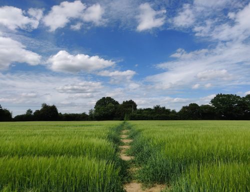
Carried out by Treeconomics, it has found that just over 10% of Babergh is covered by trees, ranging from 5.5% in the Lavenham ward, to 19% in the Orwell ward. Mid Suffolk’s coverage sits at just over 8% ranging from 6% in the Stow Thorney ward to 12.8% in the Claydon and Barham ward.
The trees are benefitting multiple public sector services by preventing more than an estimated £64m* in extra annual costs, through:
- removing more than 53,000 tonnes of carbon and storing 1.3m tonnes more
- taking out over 2,000 tonnes of pollutants from the air
- draining away almost five million cubic meters of rainwater
- improved wellbeing benefits that greener spaces bring to people.
Next month, cabinets will decide whether the full report and data, which includes trees on both council-owned and private land, should be made available as an interactive map on the councils’ website.
The councils’ aim is to use this detailed baseline data to improve tree management, as well as calculate where land is available for planting and to increase tree coverage where it will be most beneficial first. This will support the councils current schemes, such as their trees, hedgerows and wildflowers scheme.
It will also enable officers to apply for more funding streams and create a tree planting strategy. This will ensure the right trees are planted in the right places, to boost biodiversity across the districts for years to come.
If approved for publication, the data would be available to town and parish councils, community groups, landowners, planners, and developers, as well as others. This means they would be able to use it to establish what actions they can take to support and improve biodiversity locally, working with the councils.
Cllr Jessica Fleming, cabinet member for environment at Mid Suffolk District Council, said:
“Achieving biodiversity net gain and strengthening and enhancing our wildlife sites and open spaces, is fundamental to achieving our strategic priorities for the environment.
“The data from this vitally important survey provides us, and hopefully the wider public and partners, with the tools to attach a value to our trees for the first time and to focus our efforts and resources on the places that would most benefit from tree planting first.
“We also recognise the value that access to open space brings to our residents’ health and wellbeing. By continuing to work with local partners across Suffolk we can ensure we make best use of our natural environment to benefit all.”
Cllr Jane Gould, cabinet member for climate change, biodiversity, and sustainable transport at Babergh District Council, said:
“The findings of this survey, which will enable us to create a tree planting strategy for the coming years, marks another important step towards achieving our climate change and biodiversity ambitions.
“It will play a vital role in enabling us to protect and strengthen our district’s amazing wildlife and plant life, ensuring we target areas which will benefit most first.
“Because we’ve surveyed more than just our council-owned trees, and if approved for publication, it will also benefit our parishes, community groups as well as housing developers. They will be able to use the data to improve green infrastructure within new developments, and target resources, ensuring Babergh remains a place people are proud to live and work for years to come.”
These build on steps already taken by the councils to support biodiversity in their patch, including:
- gifting well over 1000 trees to new parents through their Tree for Life scheme
- introducing wildflower meadows
- working with town and parish councils, and other community groups, through their trees, hedgerows and wildflowers scheme
- successfully securing a share of £150k with other Suffolk councils to plant around 3,000 trees in the county. 200 of these are located across Broom Hill in Hadleigh, Needham Lake in Needham Market, and Greens Meadow in Stowmarket and were dedicated to the Queen’s Green Canopy in Suffolk
- finalising mapping of existing and potential wildlife corridors in partnership with Suffolk Biodiversity Information Service and Suffolk Wildlife Trust.
* Pollution damage costs are calculated using DEFRA’s UK Social Damage Cost values. Carbon values calculated using the UK’s centrally non-traded value for CO2 which is currently £70/tonne. Avoided runoff is calculated from the household sewerage volumetric charge by Anglian Water.